Methodology development
for the investigation of geological environment
Various kinds of data are obtained systematically from the surface to the deep
underground to show the geological environment as a synthesized model.
|
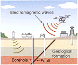
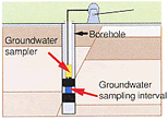
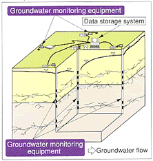
Development of monitoring
technology for geological environment
Methodology for monitoring changes in geological environment resulting from construction
of underground facilities will be developed.
|
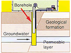
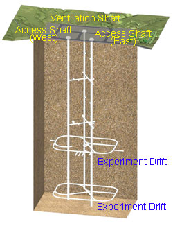
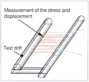
Development of basic
engineering technology for deep geological environments
Design and construction techniques for deep underground
facilities will be developed.
|
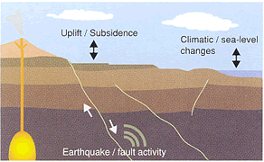
Research on long-term
stability of geological environments
Research is conducted on earthquakes, fault movements,
uplift / subsidence,climatic / sea-level changes and crustal
movements.
|